Gnats. Lots of ’em.

Posted by Meg

We haven’t had an organized team hike for a few weeks. On off weekends, Genevieve and I usually meet up for our own trail day. For the most part, we’ve been lucky with the trails we’ve picked for non-team hike days. But yesterday’s hike was not a good one.

About 2 miles in, we both looked at each other and said that if we were not training for the Xtreme Hike for CF, we would turn back to our cars and drive the 2.5 hours home, by ourselves, to our respective cities.

But we find ourselves just seven weeks away from the finale 31-mile hike day, so we trekked along for another 11 miles. We did not take a single picture. We were just trying to get finished. Here’s why it sucked:

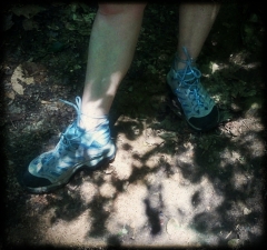
  • Rain. It rained for the first few hours. Our pruny, water-logged feet squished along in our soggy shoes for 13 miles.
  • Snakes. Unknowingly, Genevieve’s trekking pole nearly speared what looked like a timber rattler that was hanging out on the trail. That’s the kind of stuff that causes nightmares.
  • Overgrowth. The more interesting part of the hike was overgrown — like 3 and 4 foot-high overgrowth. After spotting the snake earlier, we chickened out and did not make it up to the overlook.
  • Gnats. Clouds of them followed us for 6 hours. At points, it was difficult to open our eyes as they were flying right into them. (And into our mouths.)

But enough with the negativity. On a positive side, 13 miles was not too tough, which makes us happy to see our training progress. And all of this is for a cause much more significant than a crappy hiking day.

Our fundraising is also seeing great progress — We’re about halfway to our $5,000 goal! Thank you to all who have contributed and are cheering us along. If you haven’t yet, we hope you’ll consider contributing to help us reach our goal.

  • To donate to Genevieve’s page, go here.
  • To donate to Meg’s page, go here.
  • Should you wish to write us a combined check, shoot us a note at hikingforcff@gmail.com, and we’ll send you our mailing address.
Trail Maps Can Be Misleading

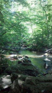
Stream in the Prince William Forest

Prince William Forest

Posted by Meg

We should probably explain that we actually don’t live in the same area. Meg lives in Richmond, while Genevieve currently lives in Northern Virginia (though, she is from Richmond, and Meg is hoping desperately that she will decide to move back). Thus, the two of us have to plan our hiking “meet-ups” accordingly.

Last Saturday, we planned a hike together in the Prince William Forest. It is actually only one of a few hiking spots off of I-95, in between NoVA and RVA. The trail guide indicated it was 7 miles, which is right along the lines of where we should be in our weekend training.

Wildlife in the Prince William Forest

We found a few froggies. But luckily missed the rattlesnake that the group in front of us warned us about.

The hike was lovely — a relatively cool summer morning was enhanced by a path that included a lot of shade. The hike did not include scenic views, but you did get a lot of opportunities to walk along streams. It was also fairly quiet, considering we were just off of 95, near Quantico. (If you’re familiar with DC traffic, you know it can be terrible right about there.)

The one qualm we would have about the experience is the way the trails were marked. Now, we are relatively novice when it comes to all of this trail map stuff, but two trails in the same forest were marked “blue” — one was a slightly lighter shade of blue. We did not realize it at the time, so leave it to us to continue onto the WRONG “blue” trail. Yep. We got lost. And our hike was cut short. (We’d like to say it was cut by only by a mile, but looking back at the map now, it could’ve been more.)

Also, we learned the importance of properly fitting hiking boots. Meg got a terrible blister, and had to turn her hiking boots into clogs before it was all over. Quite the fashion statement.

Hiking "clogs"

Hiking “clogs”

We’d do this trail again, but would pay closer attention to the map.